
MACISTE - ICE
WebGIS for polar coastal areas. The geodatabase has been optimised to manage polar environmental data: it is possible to insert specific information on the sampling area such as ice cover or set opportune tolerance thresholds for the validation of the input data during the data input phase.
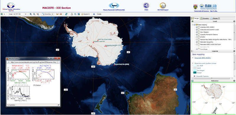
Go to the MACISTE-ICE (Antarctic) site (Antartide)
