MACISTE - MPA
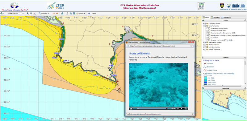
MACISTE-MPA: WebGIS for protected marine areas. As well as providing multidisciplinary management of environmental data (physical, chemical and biological) and specialised maps, it has an Impact section (fishing, pleasure craft, scubadiving, tourism). The output (reporting, maps, WMS WFS services, etc.) makes it possible to use MACISTE as an AMP management tool. The system is functioning in the Portofino Protected Marine Area
Go to the website
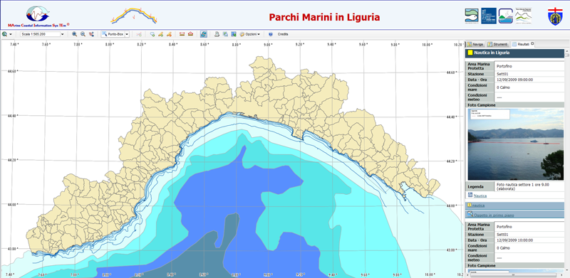
REte MARE MACISTE-MPA (www.remare.org) Network of Ligurian marine parks
Go to the website
Portofino M.P.A MACISTE-MPA (A.M.P. Portofino)
